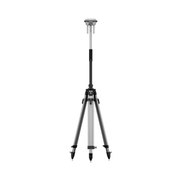
DJI D-RTK 3 Multifunctional Station & Base Tripod Kit
RM8250.00
The new D-RTK 3 Multifunctional Station integrates high-performance antennas and receiver modules capable of tracking and resolving data from major global satellite navigation systems, and it supports multiple data transmission links. With these outstanding features, it can serve as a base station to provide centimeter-level positioning for multiple drones simultaneously or extend the operational range of drones in relay station mode. Additionally, the new rover station mode, combined with the DJI Enterprise app and DJI Terra, provides a comprehensive solution for high-precision aerial surveying applications, ensuring a secure and accurate operation.
Specs
GNSS Receiver
GNSS Frequency
GPS: L1C/A, L2C, L5
BDS: B1I, B2I, B3I, B1C, B2a, B2b
GALILEO: E1, E5a, E5b, E6
GLONASS: L1, L2
QZSS: L1C/A, L2C, L5
L-Band
System Accuracy*
Base Station Mode (Broadcast Mode) and Relay Station Mode
Base Station Accuracy:
Single Point Accuracy (Uncalibrated):
Horizontal: 1.5 m (RMS)
Vertical: 3.0 m (RMS)
Satellite-Based Differential Accuracy:
Convergence Time: 20 mins
Horizontal: 30 cm (RMS)
Vertical: 40 cm (RMS)
Network RTK Calibration**:
Horizontal: 1.0 cm (RMS) + 1 ppm
Vertical: 3.0 cm (RMS) + 1 ppm
Rover Station Mode
RTK Accuracy (Fixed Survey)*:
Horizontal: 0.8 cm (RMS) + 1 ppm
Vertical: 1.5 cm (RMS) + 1 ppm
RTK Accuracy (Tilt Survey)***:
Angle Range: 0° to 60°
Horizontal: 8 mm + 0.7 mm/° tilt (accuracy <2 cm within 30°)
* Measurement accuracy depends on various factors. This value is obtained under normal conditions with an unobstructed view, good satellite distribution, low ionospheric activity, and no electromagnetic interference or multipath effects.
** Base station calibration coordinate accuracy depends on various factors. For surveying, high-precision flight paths, etc., it is recommended to calibrate during periods of inactive ionosphere, in open, unobstructed environments with no electromagnetic interference or multipath effects, using four or more GNSS systems.
*** Intense vibrations and rapid rotations can affect the accuracy of the inertial measurement unit.
Satellite-Based Precise Point Positioning*
Supported Frequencies: BDS B2b, GALILEO E6, L-BAND**
Convergence Time: 20 mins
Horizontal: 30 cm (RMS)
Vertical: 40 cm (RMS)
* Measurement accuracy depends on various factors. This value is obtained under normal conditions with an unobstructed view, good satellite distribution, low ionospheric activity, and no electromagnetic interference or multipath effects.
** Will be supported in later versions.
Differential Data Transmission Format
When used as a base station or relay station, records RTCM 3.2 raw observation data in DAT format.
In rover station mode or in calibration mode for base and relay stations:
1. Supports RTCM v3.0, v3.1, v3.2, v3.3, MSM4, MSM5, MSM6, MSM7 protocols.
2. It is recommended to use receivers that support four or more GNSS systems.
Initialization Reliability
>99.9%